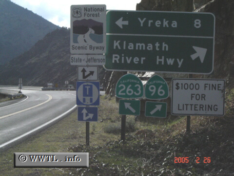
(Junction State Route 263; Siskiyou County, California)
--Photo taken by Carlos Rogers c. 2000s ✔
Viatype:S4-D
Map Location: 41.83228, -122.59132![]()
Junction State Route 263. Notice the "State of Jefferson" tag
(just below the Scenic Byway sign)? The idea of a "Jefferson
State" began as a movement in
1941, when residents of northern California and southern Oregon tried to form
their own state. The movement eventually flopped--however to this very
day, many of these residents still have strong feelings for its creation.
Next
photo>>>
<<<Previous
photo
![]()
![]()
![]()
![]()
Distance Chart for
California 96
California 96
| Happy Camp, California | |||||
| 111 | Hornbrook, California | ||||
| 243 | 132 | Willow Creek, California | |||
Approximate distance in km
(1 km = 0.621 miles)
(1 km = 0.621 miles)