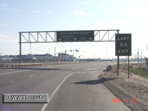
(Southbound State Route 7; Imperial County, California)
--Photo taken by Carlos Rogers in 2006 ✔
Viatype:S4-D
Map Location: 32.68819, -115.37943![]()
At this junction, passenger and commercial-vehicles get separated. To the left is a gas-station with 15+ pumps, which appearingly caters to Mexicans wishing for cheaper American gasoline. Interestingly. as I drove this route, there were more "Baja California Front" license-plates showing than those from California. This suggests that the USA and México have some degree of economic dependence on another, and seemingly thwarts suggestions that open-borders are not good for the economy.
Next photo>>>
<<<Previous
photo
Distance Chart for
California 7
California 7
| International Border | |||||
| 3.1 | Junction California 98 | ||||
| 12 | 8.9 | Junction Interstate 8 | |||
Approximate distance in km
(1 km = 0.621 miles)
(1 km = 0.621 miles)