(End Northbound State Route 67; Ramona, California)
--Photo taken by Eric Lozaga c. 2000s ✔
Map Location: 33.04197, -116.86864![]()
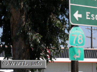
At State Route 67's northern terminus, there is a choice of State Route 78 west (to the left) or east (just ahead).
Distance Chart for
California 67
California 67
| El Cajon, California | |||||
| 32 | Potato Chip Rock | ||||
| 44 | 12 | Ramona, California | |||
Approximate distance in km
(1 km = 0.621 miles)
(1 km = 0.621 miles)