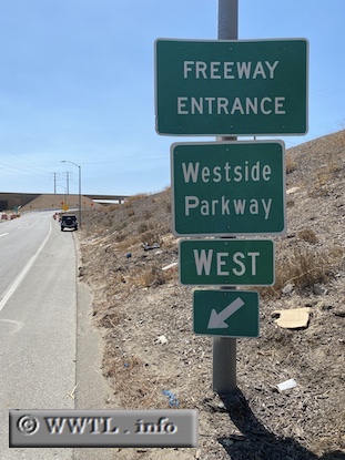
(Entrance to Westbound Future Route 58; Bakersfield, California)
--Photo taken by Carlos Rogers in 2020 ✔
Map Location: 35.37184, -119.05571![]()
As of 2020, there is a special freeway in Bakersfield called the Westside Parkway. Once its construction has completed, Route 58 will overtake the path and provide a high-speed path from downtown to Stockdale Highway.
Next
photo>>>
<<<Previous
photo
![]()
![]()
![]()
![]()
Distance Chart for
California 58
California 58
| Bakersfield, California | |||||
| 209 | Barstow, California | ||||
| 178 | 387 | Santa Margarita, California | |||
Approximate distance in km
(1 km = 0.621 miles)
(1 km = 0.621 miles)