(Eastbound Interstate 80 @ junction California
Route 480; San Francisco, California)
--Photo taken by Carlos Rogers c. 2000s ✔
Map Location: 37.78305, -122.39516![]()
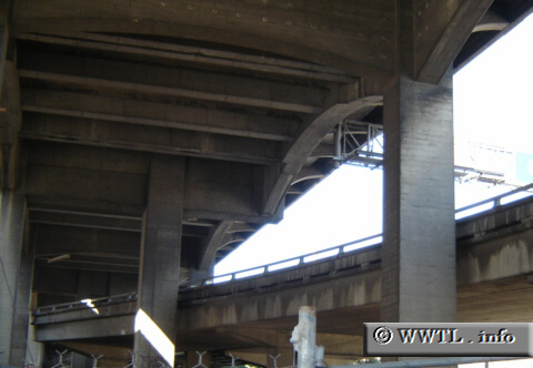
Former Route 480 connected Interstate 80 to the northeastern neighbourhoods of San Francisco. Route 480 overlay the Embarcardero and terminated in the north near Pier 39. What you see in the picture above is the transition ramp from Interstate 80 to State Route 480, as taken in 2005. This ramp was closed to traffic in '05, since Route 480 was essentially dead due to its collapse in the 1989 Loma Prieta earthquake. Think of this ramp as a remnant. As of today, it no longer exists due to reconstruction of Interstate 80 near the Bay Bridge.
| Distance Chart for Former California 480
Approximate distance in km (1 km = 0.621 miles) | ||||||||||||||||||