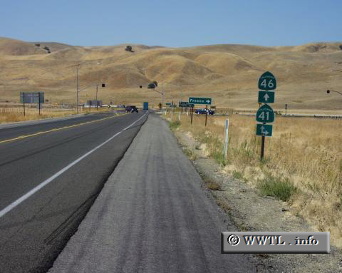
(Westbound State Route 46; San Luis Obispo County, California)
--Photo taken by Fred Abse c. 2000s ✔
Map Location: 35.73478, -120.28271![]()
Many baby-boomers recognise
this intersection all too well. On 30 September 1955, famous actor James Dean
was traveling westbound on State Route 46 (then known as Federal Route 466) when Donald Turnupseed,
a California college student, collided head-on during a turn onto northbound
State Route 41. Dean died shortly thereafter, at the age of 24. Since that
time, the intersection has been outfitted with safety-devices like warning
lights and improved markings.
<<<Previous
photo
Distance Chart for
California 46
California 46
| Lost Hills, California | |||||
| 97 | Paso Robles, California | ||||
| 34 | 131 | Wasco, California | |||
Approximate distance in km
(1 km = 0.621 miles)
(1 km = 0.621 miles)