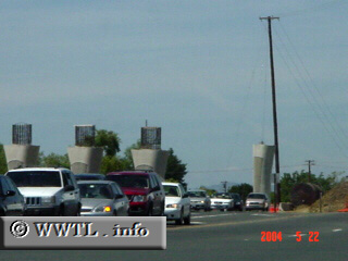
(Intersection of Sonoma Boulevard and Marine World
Pkwy.; Vallejo, California)
--Photo taken by Carlos Rogers c. 2000s ✔
Viatype:S4-D
Map Location: 38.13787, -122.25602![]()
The pillars in the background are part of the State Route 37 freeway extension project, which upon completion will allow limited-access travel from Junction Interstate 80 with Mare Island.
Next
photo>>>
<<<Previous
photo
Distance Chart for
California 37
California 37
| Novato, California | |||||
| 17 | Sears Point, California | ||||
| 36 | 19 | Vallejo, California | |||
Approximate distance in km
(1 km = 0.621 miles)
(1 km = 0.621 miles)