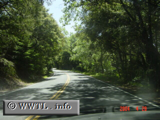
(Northbound Skyline Boulevard.; Santa Clara County,
California)
--Photo taken by Carlos Rogers c. 2000s ✔
Viatype:S2-U
Map Location: 37.2592, -122.12285![]()
Highway 35 leads its path through the San Francisco Peninsula.
Next
photo>>>
<<<Previous
photo
Distance Chart for
California 35
California 35
| Redwood Estates, California | |||||
| 111 | San Francisco | ||||
| 54 | 57 | Sky Londa, California | |||
Approximate distance in km
(1 km = 0.621 miles)
(1 km = 0.621 miles)