(End Northbound State Route 261; Orange County,
California)
--Photo taken by Carlos Rogers c. 2000s ✔
Viatype:F4-D
Map Location: 33.78391, -117.7478![]()
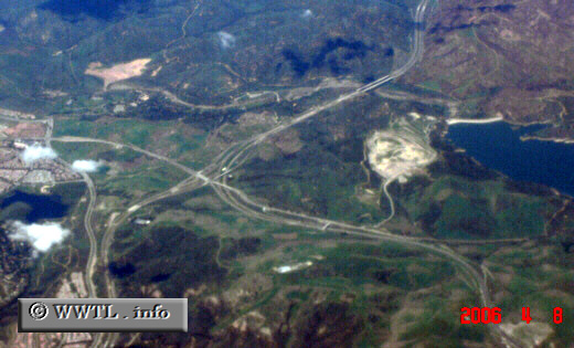
The route snakes from the bottom lefthand corner of the image to its
terminus with the State Route 241 tollroad. At this interchange, State Route 241 pulls a
near ninety-degree bend to the north (i.e., top).
Distance Chart for
California 261
California 261
| Irvine, California | |||||
| 5.9 | Jct Interstate 5 (via Jamboree) | ||||
| 15 | 9.1 | Junction California 241 | |||
Approximate distance in km
(1 km = 0.621 miles)
(1 km = 0.621 miles)