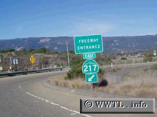
(Eastbound State Route 217, Goleta, California)
--Photo taken by Dan Peri c. 2000s ✔
Map Location: 34.41931, -119.83084![]()
Getting close to the US 101 connector!
<<<Previous
photo
![]()
![]()
![]()
![]()
Distance Chart for
California 217
California 217
| Goleta, California | |||||
| 0.7 | Junction Federal Route 101 | ||||
| 3.7 | 4.4 | Santa Barbara Airport | |||
Approximate distance in km
(1 km = 0.621 miles)
(1 km = 0.621 miles)