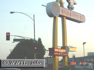
(Southbound Lakewood Boulevard; Downey, California)
--Photo taken by Dan Peri c. 2000s ✔
Viatype:S4-D
Map Location: 33.94707, -118.11756
Although the numbers on the Highway 19 shield are barely visible at this intersection (likely due to smog residue), the view of McDonald's golden arches is hard to miss!
Distance Chart for
California 19
California 19
| Downey, California | |||||
| 25 | East Pasadena, California | ||||
| 20 | 45 | Eastside, Long Beach | |||
Approximate distance in km
(1 km = 0.621 miles)
(1 km = 0.621 miles)