| | 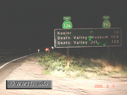
(Eastbound State Route 136; Inyo County, California)
--Photo taken by Carlos Rogers in 2005 ✔
Viatype:S2-U
Map Location: 36.57928, -118.05622
Highway 136 is a major connector between Independence and the Death Valley
National Park. Though the photograph above shows a cosignment of State Route 136
and State Route 190, the routes never overlap. Instead, State Route 136 feeds traffic into
the Death Valley's main artery, State Route 190.
Next photo>>>
| |