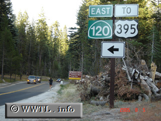
(Eastbound North Yosemite Highway; Yosemite
Nat'l Park, California)
--Photo taken by Carlos Rogers in 2005 ✔
Viatype:S2-U
Map Location: 37.75231, -119.79828![]()
Though state highways cannot legally exist in federal government areas,
trailblazer signage for State Route 120 is given for motorist convenience.
<<<Previous photo
Distance Chart for
California 120
California 120
| Manteca, California | |||||
| 34 | Oakdale, California | ||||
| 116 | 150 | Yosemite Nat'l Park | |||
Approximate distance in km
(1 km = 0.621 miles)
(1 km = 0.621 miles)