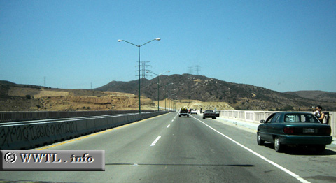
( (Southbound State Route 201; Tijuana municipality, Baja
California))
--Photo taken by Carlos Rogers in 2006 ✔
Viatype:F4-D
Map Location: 32.42589, -116.88718![]()
English |
español
This four-lane bridge crosses high over a local lagoon. The water and wildlife is a beautiful, natural sight and isn't terribly far from downtown Tijuana. Unfortunately, graffiti already covers the median barrier.
Next photo>>>
<<<Previous
photo
Distance Chart for
Baja California 201
Baja California 201
| El Refugio, Tijuana | |||||
| 9 | Junction Federal Route 2D | ||||
| 33 | 42 | Popotla, Rosarito | |||
Approximate distance in km
(1 km = 0.621 miles)
(1 km = 0.621 miles)