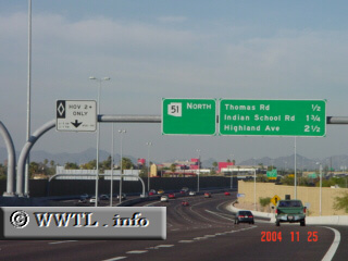
 (Northbound Piestewa Freeway; Phoenix, Arizona) --Photo taken by Carlos Rogers c. 2000s ✔ Viatype:F4-D Map Location: 33.47248, -112.03842 Highway 51 travels through eastern Phoenix, and allows motorists to view Camelback Mountain and Squaw Peak along the way.
|
| ||||||||||||||||||||||||