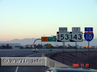
(Southbound State Route 153; Phoenix, Arizona)
--Photo taken by Carlos Rogers c. 2000s ✔
Viatype:F4-D
Map Location: 33.42984, -111.98012![]()
Near Highway 153's southern terminus, advanced guide-signage is given for Arizona State Route 143 and Interstate 10.
<<<Previous
photo
![]()
![]()
![]()
![]()
Distance Chart for
Former Arizona 153
Former Arizona 153
| Junction University Drive | |||||
| 5.1 | Phoenix Gateway, Phoenix | ||||
| 3 | 2.1 | Phoenix Int'l Airport | |||
Approximate distance in km
(1 km = 0.621 miles)
(1 km = 0.621 miles)