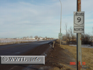
(Northbound Primary Provincial Route 9; M.D. 44, Alberta)
--Photo taken by Carlos Rogers in 2005 ✔
Viatype:S2-U
Map Location: 51.03833, -113.67928![]()
English | français
An unique distinction of Highway 9 is its shift in directional
orientation. It is signed as north-south between Trans-Canada Route 1 and Provincial Route 72, and then
becomes signed east-west towards the border-crossing at Saskatchewan.
| Distance Chart for Alberta 9
Approximate distance in km (1 km = 0.621 miles) | ||||||||||||||||||||||||||||||||