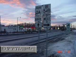
(Southbound Provincial Route 2A ; Okotoks, Alberta)
--Photo taken by Carlos Rogers in 2005 ✔
Viatype:S4-D
Map Location: 50.72642, -113.98253![]()
English | français
The southernmost designation of Provincial Route 2A connects Cayley with the southern-outskirts
of Calgary. This route was once a part of Provincial Route 2, well before construction of its present dual-carriageway
(to the east).
| Distance Chart for Alberta 2A
Approximate distance in km (1 km = 0.621 miles) | ||||||||||||||||||