Canada
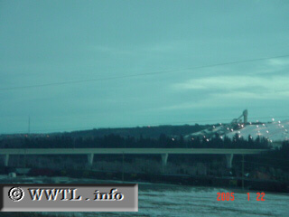
(looking at Southbound Stoney Trail; Calgary, Alberta)
--Photo taken by Carlos Rogers in 2005
✔
Viatype:
F4-D
Map Location:
51.09837, -114.23224
English |
français
The bridge in the lower-center crosses the Bow River.
<<<Previous photo
Share with:
Share information about this road!
Distance Chart for
Alberta 201
Auburn Bay, Calgary
38
Northwest Calgary, Calgary
15
23
Two Guns, Alberta
Approximate distance in km
(1 km = 0.621 miles)